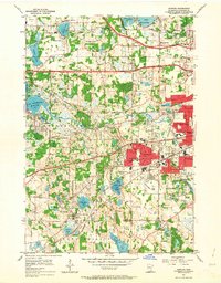
1954 Map of Hopkins
USGS Topo · Published 1964About this map
Hopkins and St Louis Park serve as the bustling centers of this mid-century suburban expansion west of the Twin Cities. The landscape is a network of developing residential grids and significant institutional sites, including the Minneapolis Penal Institution and the Glen Lake Sanatorium. To the west, the map reaches the shoreline of Lake Minnetonka at Grays Bay and Wayzata Bay, where the transition from water to woodlot begins to yield to housing.
Find a feature on this map
66 named features on this map. Tap any name to fly to it.
Don’t see what you’re looking for? This feature index may not catch every label — zoom into the map to look around manually.
Map Details
Editions of this 1954 Hopkins Map
2 editions found

Other maps of this area

1896 · Minneapolis
USGS Topo · 1:62,500

1901 · Minneapolis
USGS Topo · 1:62,500

1902 · Anoka
USGS Topo · 1:62,500

1905 · Minnetonka
USGS Topo · 1:62,500

1907 · Minnetonka
USGS Topo · 1:62,500

1909 · Rockford
USGS Topo · 1:62,500

1952 · Minneapolis North
USGS Topo · 1:24,000

1952 · Minneapolis South
USGS Topo · 1:24,000

1953 · Saint Paul
USGS Topo · 1:250,000

1953 · Stillwater
USGS Topo · 1:250,000