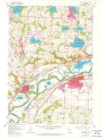
1958 Map of Shakopee
USGS Topo · Published 1973About this map
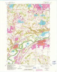
The Minnesota River corridor anchors this mid-century look at the developing river towns of Shakopee, Chaska, and Carver. The landscape is a complex network of wetlands and small lakes, including Rice Lake, Lake Riley, and Nyssens Lake, many of which are connected by Bluff Creek or the Minnesota River floodplains. Extensive rail infrastructure from the Chicago and North Western and the Chicago Milwaukee St Paul and Pacific railroads parallels the river, servicing a local economy characterized by numerous Gravel Pits and industrial sites.
Find a feature on this map
53 named features on this map. Tap any name to fly to it.
Don’t see what you’re looking for? This feature index may not catch every label — zoom into the map to look around manually.
Map Details
Editions of this 1958 Shakopee Map
5 editions found
Other maps of this area

1896 · Minneapolis
USGS Topo · 1:62,500

1901 · Minneapolis
USGS Topo · 1:62,500

1905 · Minnetonka
USGS Topo · 1:62,500

1907 · Minnetonka
USGS Topo · 1:62,500

1953 · Saint Paul
USGS Topo · 1:250,000

1954 · Hopkins
USGS Topo · 1:24,000

1954 · Eden Prairie
USGS Topo · 1:24,000

1954 · Minneapolis
USGS Topo · 1:62,500

1957 · Prior Lake
USGS Topo · 1:62,500

1957 · New Prague
USGS Topo · 1:62,500