
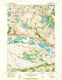
1954 Map of Eden Prairie
USGS Topo · Published 1956About this map
The Minnesota River carves a deep valley through this mid-century landscape, separating Hennepin and Scott Counties. The northern uplands of Eden Prairie and Bloomington are characterized by a dense concentration of kettle lakes, including Staring Lake, Bush Lake, and the Anderson Lakes chain. Local aviation is anchored by Flying Cloud Airport, while the agrarian past is still visible in the scattered Eden Prairie Ch and multiple rural burial grounds such as Valley Cem and Glendale Cem.
Find a feature on this map
43 named features on this map. Tap any name to fly to it.
Don’t see what you’re looking for? This feature index may not catch every label — zoom into the map to look around manually.
Map Details
Editions of this 1954 Eden Prairie Map
2 editions found
Other maps of this area

1896 · Minneapolis
USGS Topo · 1:62,500

1901 · Minneapolis
USGS Topo · 1:62,500

1905 · Minnetonka
USGS Topo · 1:62,500

1907 · Minnetonka
USGS Topo · 1:62,500

1952 · Minneapolis South
USGS Topo · 1:24,000

1953 · Saint Paul
USGS Topo · 1:250,000

1954 · Hopkins
USGS Topo · 1:24,000

1954 · Bloomington
USGS Topo · 1:24,000

1954 · Minneapolis
USGS Topo · 1:62,500

1957 · Prior Lake
USGS Topo · 1:62,500