
1954 Map of Bloomington
USGS Topo · Published 1956About this map
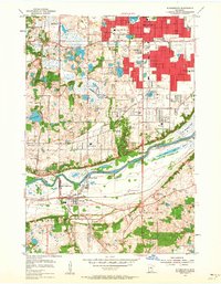
The Minnesota River valley serves as the central artery for this mid-1950s survey, marking the transition from the growing suburban developments of Richfield and Bloomington to the more open landscapes of Burnsville and Savage. Industrial activity is concentrated along the riverbanks at Port Cargill, where the Minneapolis Northfield and Southern railway connects with river commerce. This era shows a community in flux, with established institutions like the Minnesota Masonic Home and the Minnesota Valley Country Club standing alongside newer symbols of post-war expansion, such as the Drive-in Theater and numerous neighborhood schools like Westwood Sch.
Find a feature on this map
62 named features on this map. Tap any name to fly to it.
Don’t see what you’re looking for? This feature index may not catch every label — zoom into the map to look around manually.
Map Details
Editions of this 1954 Bloomington Map
2 editions found
Other maps of this area

1896 · Minneapolis
USGS Topo · 1:62,500

1896 · St. Paul
USGS Topo · 1:62,500

1901 · Minneapolis
USGS Topo · 1:62,500

1951 · St. Paul West
USGS Topo · 1:24,000

1951 · St. Paul SW
USGS Topo · 1:24,000

1951 · St. Paul
USGS Topo · 1:62,500

1952 · Minneapolis South
USGS Topo · 1:24,000

1953 · Saint Paul
USGS Topo · 1:250,000

1954 · Hopkins
USGS Topo · 1:24,000

1954 · Eden Prairie
USGS Topo · 1:24,000