2024 Map of Shannon
USGS Topo · Published 2024About this map
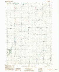
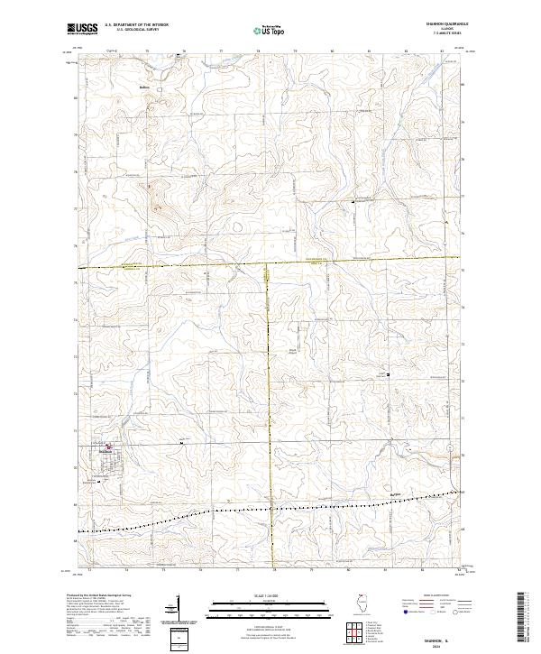
The village of Shannon serves as a central hub in this agricultural landscape where the borders of Stephenson, Carroll, and Ogle Counties converge. The terrain is defined by a dendritic network of waterways including the Leaf River, Elkhorn Creek, and Lost Creek, which cut through the farm plots of Northern Illinois. Small settlements like Bolton and Harper anchor the surrounding rural sections, connected by a strictly gridded road system that follows early land survey lines. Genealogists will find a significant concentration of burial sites throughout the area, such as the Shelly Cemetery and the Lane Evangelical United Baptist Cemetery. The presence of Sneek Airport and the intersection of North State Route 26 illustrate the modern transportation infrastructure that supports the local economy and residents in this multi-county region.
Find a feature on this map
68 named features on this map. Tap any name to fly to it.
Don’t see what you’re looking for? This feature index may not catch every label — zoom into the map to look around manually.
Map Details
Editions of this 2024 Shannon Map
This is the sole edition of this map. No revisions or reprints were ever made.