2024 Map of Sharpsburg
USGS Topo · Published 2024About this map
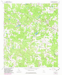
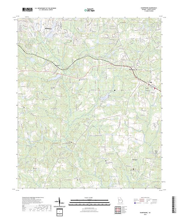
White Oak Creek and its many tributaries, including Sullivan Branch and Little White Oak Creek, define the landscape of eastern Coweta County. This area south of Newnan is characterized by a dense network of country churches and historic burial grounds that speak to the long-standing community roots in the region. Notable sites include the White Oak Associated Reform Presbyterian Cem and the Mount Gilead United Methodist Cem. In the southeast, the local economy and geography center around Elders Mill and Elders Millpond, while the small towns of Sharpsburg and Turin serve as local hubs along the eastern edge of the quadrangle. The map captures a sophisticated mix of residential development, particularly around Steward Lakes and Paradise Lakes, alongside agricultural land and several family-named cemeteries such as Pitts Cem and the Elder Linch Cem.
Find a feature on this map
216 named features on this map. Tap any name to fly to it.
Don’t see what you’re looking for? This feature index may not catch every label — zoom into the map to look around manually.
Map Details
Editions of this 2024 Sharpsburg Map
This is the sole edition of this map. No revisions or reprints were ever made.