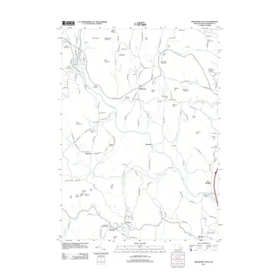
2012 Map of Shelburne Falls
USGS Topo · Published 2012About this map
The Deerfield River carves a deep valley through Franklin County, anchoring a landscape defined by small Massachusetts agricultural hamlets and rugged ridges. In the southern portion of the quadrangle, the village of Conway sits near the S River, notable for the historic Burkeville Covered Bridge and the nearby Howland Cem. To the north, the township of Shelburne is surrounded by high elevations like Massaemett Mountain and Bald Mountain, with orchards and fruit farms dotting the hillsides near The Patten.
Find a feature on this map
165 named features on this map. Tap any name to fly to it.
Don’t see what you’re looking for? This feature index may not catch every label — zoom into the map to look around manually.
Map Details
Editions of this 2012 Shelburne Falls Map
This is the sole edition of this map. No revisions or reprints were ever made.
Other maps of this area

1885 · Northampton
USGS Topo · 1:62,500

1886 · Hawley
USGS Topo · 1:62,500

1886 · Chesterfield
USGS Topo · 1:62,500

1886 · Northampton
USGS Topo · 1:62,500

1888 · Chesterfield
USGS Topo · 1:62,500

1890 · Hawley
USGS Topo · 1:62,500

1890 · Greenfield
USGS Topo · 1:62,500

1891 · Northampton
USGS Topo · 1:62,500

1893 · Northampton
USGS Topo · 1:62,500

1893 · Chesterfield
USGS Topo · 1:62,500