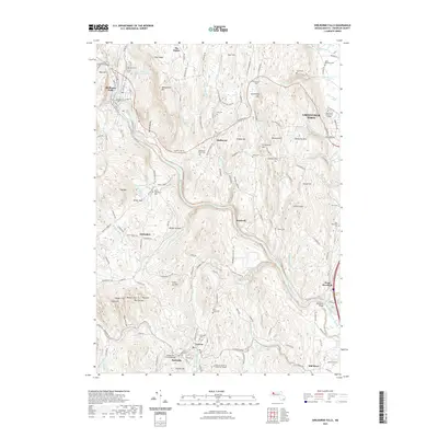
2021 Map of Shelburne Falls
USGS Topo · Published 2021About this map
Shelburne Falls anchors the northwestern corner of this territory, where the Deerfield River cuts through a landscape defined by significant elevation changes between West Mtn and Massaemett Mtn. The river’s path dictates the placement of early industry and transport, passing the Conway Electric Reservoir and flowing under the Stillwater Bridge toward West Deerfield. Local history is deeply etched into the hillsides, marked by numerous small burial grounds such as North Shirkshire Cem and Pine Grove Cem, which served the scattered farming settlements of Shirkshire, The Patten, and Bardwell.
Find a feature on this map
165 named features on this map. Tap any name to fly to it.
Don’t see what you’re looking for? This feature index may not catch every label — zoom into the map to look around manually.
Map Details
Editions of this 2021 Shelburne Falls Map
This is the sole edition of this map. No revisions or reprints were ever made.
Other maps of this area

1885 · Northampton
USGS Topo · 1:62,500

1886 · Hawley
USGS Topo · 1:62,500

1886 · Chesterfield
USGS Topo · 1:62,500

1886 · Northampton
USGS Topo · 1:62,500

1888 · Chesterfield
USGS Topo · 1:62,500

1890 · Hawley
USGS Topo · 1:62,500

1890 · Greenfield
USGS Topo · 1:62,500

1891 · Northampton
USGS Topo · 1:62,500

1893 · Northampton
USGS Topo · 1:62,500

1893 · Chesterfield
USGS Topo · 1:62,500