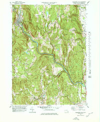
1978 Map of Shelburne Falls
USGS Topo · Published 1979About this map
The Deerfield River carves a dramatic path through this Franklin County landscape, centering on the village of Shelburne Falls. This late-1970s view reveals a community deeply integrated with its topography, where the Boston And Maine Railroad follows the river's bend while the historic Mohawk Trail traverses the higher elevations. The map is a significant resource for genealogists, detailing numerous family-named burial grounds like Howland Cem, Arms Cem, and Skinner Cem.
Find a feature on this map
85 named features on this map. Tap any name to fly to it.
Don’t see what you’re looking for? This feature index may not catch every label — zoom into the map to look around manually.
Map Details
Editions of this 1978 Shelburne Falls Map
This is the sole edition of this map. No revisions or reprints were ever made.
Other maps of this area

1885 · Northampton
USGS Topo · 1:62,500

1886 · Hawley
USGS Topo · 1:62,500

1886 · Chesterfield
USGS Topo · 1:62,500

1886 · Northampton
USGS Topo · 1:62,500

1888 · Chesterfield
USGS Topo · 1:62,500

1890 · Hawley
USGS Topo · 1:62,500

1890 · Greenfield
USGS Topo · 1:62,500

1891 · Northampton
USGS Topo · 1:62,500

1893 · Northampton
USGS Topo · 1:62,500

1893 · Chesterfield
USGS Topo · 1:62,500