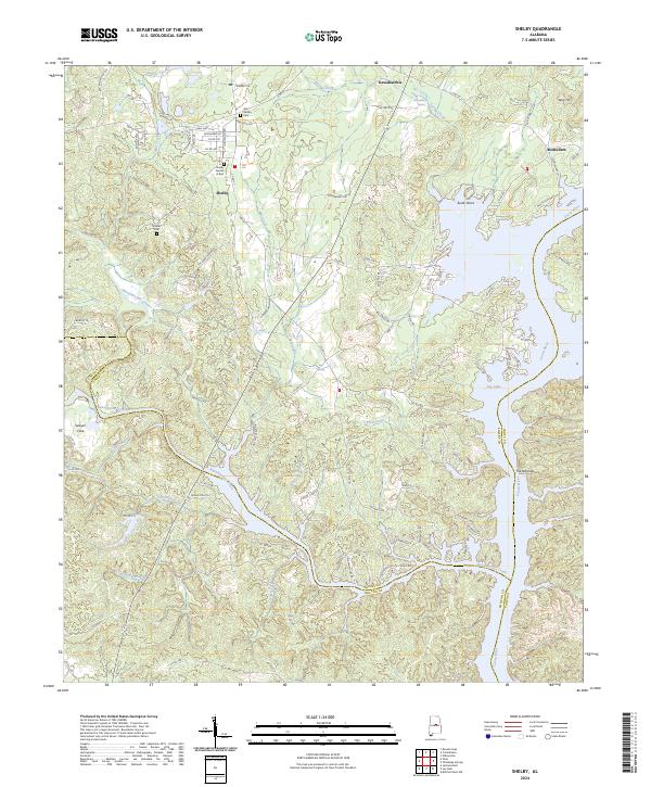
2024 Map of Shelby
USGS Topo · Published 2024About this map
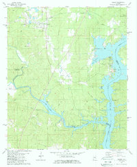
The town of Shelby and the settlement of Kewahatchie anchor this modern survey of the Alabama landscape where the Coosa River flows into the expansive Lay Lake. The region is defined by its complex drainage network, where Buxahatchee Creek and Waxahatchee Creek converge near the Chilton and Shelby County line. Local history is deeply embedded in the land, visible through sites like the Old Shelby Cem and the Brasher Cem. Geologic features such as Kelley Mtn and The Narrows provide distinct topographical relief, while Sawyer Cove sits nestled in the western reaches of the sheet. The map documents a transition from these upland terrain features to the managed waters of the Coosa, illustrating how the reservoir has reshaped the river's original path near Turtle Point.
Find a feature on this map
103 named features on this map. Tap any name to fly to it.
Don’t see what you’re looking for? This feature index may not catch every label — zoom into the map to look around manually.
Map Details
Editions of this 2024 Shelby Map
This is the sole edition of this map. No revisions or reprints were ever made.