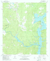
1980 Map of Shelby
USGS Topo · Published 1987About this map
The Nashville and Louisville rail line serves as a central corridor through this 1980s landscape, connecting the town of Shelby with smaller communities like Mostellers. This era captures a river system transformed, where the Coosa River broadens into the sprawling reaches of Lay Lake. The map reveals a deeply etched drainage network including Waxahatchee Creek and Beaver Creek, where the rugged topography of Kelley Mountain meets the water. Local heritage is preserved through landmarks like Providence Ch, Brasher Cem, and the Gardens of Rest. The presence of several Chert Pits near the mountain and the various boat ramps along the shoreline point to the dual nature of the region's economy, balancing industrial resource extraction with the recreational growth of the mid-twentieth century.
Find a feature on this map
34 named features on this map. Tap any name to fly to it.
Don’t see what you’re looking for? This feature index may not catch every label — zoom into the map to look around manually.
Map Details
Editions of this 1980 Shelby Map
2 editions found
Other maps of this area

1890 · Bessemer
USGS Topo · 1:125,000

1890 · Talladega
USGS Topo · 1:125,000

1891 · Clanton
USGS Topo · 1:125,000

1892 · Talladega
USGS Topo · 1:125,000

1892 · Bessemer
USGS Topo · 1:125,000

1901 · Wetumpka
USGS Topo · 1:125,000

1903 · Wetumpka
USGS Topo · 1:125,000

1909 · Columbiana
USGS Topo · 1:62,500

1911 · Columbiana
USGS Topo · 1:62,500

1915 · Gantts Quarry
USGS Topo · 1:48,000