
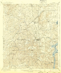
1911 Map of Columbiana
USGS Topo · Published 1911About this map
Industrial and rail infrastructure defines this portion of Shelby County, where the Rome and Columbiana Line and the Southern Railway converge near important early settlements. The town of Columbiana sits as a central hub for the Huntsville Road, while the village of Shelby is positioned near the Alabama Mineral Division tracks, reflecting the era's reliance on mineral extraction and transport.
Find a feature on this map
57 named features on this map. Tap any name to fly to it.
Don’t see what you’re looking for? This feature index may not catch every label — zoom into the map to look around manually.
Map Details
Editions of this 1911 Columbiana Map
2 editions found
Other maps of this area

1890 · Bessemer
USGS Topo · 1:125,000

1890 · Talladega
USGS Topo · 1:125,000

1891 · Clanton
USGS Topo · 1:125,000

1892 · Talladega
USGS Topo · 1:125,000

1892 · Bessemer
USGS Topo · 1:125,000

1901 · Wetumpka
USGS Topo · 1:125,000

1903 · Wetumpka
USGS Topo · 1:125,000

1905 · Bessemer Iron District
USGS Topo · 1:62,500

1906 · Vandiver
USGS Topo · 1:62,500

1907 · Bessemer Special
USGS Topo · 1:62,500