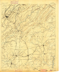
1890 Map of Bessemer
USGS Topo · Published 1890About this map
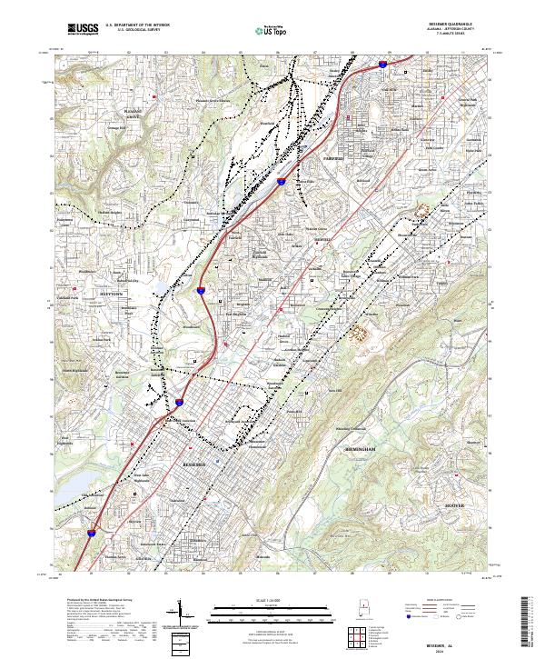
Industrial expansion defines this 1890 landscape, where the iron and coal sectors are rapidly reshaping central Alabama. The city of Bessemer stands as a primary hub, surrounded by a dense web of transportation including the Dummy Railroad and the Birmingham Mineral Railroad. These lines connect essential extractive sites like Smith Mine and industrial settlements such as Oxmoor, Sloss, and Hillman. The map reveals the intricate relationship between natural resources and infrastructure, with Peels Dam and various iron works utilizing the region's geography.
Find a feature on this map
154 named features on this map. Tap any name to fly to it.
Don’t see what you’re looking for? This feature index may not catch every label — zoom into the map to look around manually.
Map Details
Editions of this 1890 Bessemer Map
This is the sole edition of this map. No revisions or reprints were ever made.
Historical Maps of Birmingham Through Time
9 maps found