Loading...
Loading map...2023 Map of Shinnston
USGS Topo · Published 2023About this map
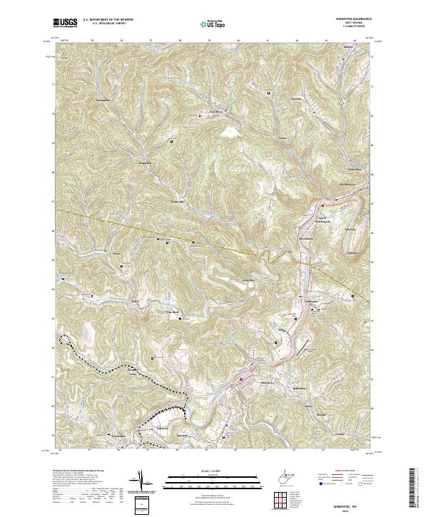
Shinnston and the surrounding coal-country communities of north-central West Virginia are documented here, following the winding course of the West Fork River. The landscape is a complex network of narrow valleys and ridges, defined by the border between Marion Co and Harrison Co. Industrial legacy is evident in the presence of the Williams Mine and Williams Mine Rd, alongside established settlements like Lumberport, Enterprise, and Worthington.
Find a feature on this map
67 named features on this map. Tap any name to fly to it.
Don’t see what you’re looking for? This feature index may not catch every label — zoom into the map to look around manually.
Map Details
Date Portrayed2023
Date Published2023
PublisherU.S. Geological Survey
Map TypeTopographic
Scale1:24000
Physical Dimensions24 x 29 inches
Editions of this 2023 Shinnston Map
This is the sole edition of this map. No revisions or reprints were ever made.
Historical Maps of Allied Through Time
Featured Locations
Source Details
SourceU.S. Geological Survey
CopyrightPublic Domain