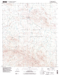
1996 Map of Sil Nakya
USGS Topo · Published 2002About this map
St Agatha Mission serves as a spiritual anchor for the settlement of Sil Nakya, located within the desert landscape of the Tohono O'odham Indian Reservation. This late-twentieth-century study of Pima County reveals a landscape where survival and geography are inextricably linked by water sources such as Frog Well and Nawi Vaya Well. The terrain transitions from the open Pipyak Valley in the north through the Sil Nakya Hills and down into the southern reaches of the North Comobabi Mountains.
Find a feature on this map
20 named features on this map. Tap any name to fly to it.
Don’t see what you’re looking for? This feature index may not catch every label — zoom into the map to look around manually.
Map Details
Editions of this 1996 Sil Nakya Map
This is the sole edition of this map. No revisions or reprints were ever made.
Other maps of this area

1934 · Silver Bell
USGS Topo · 1:125,000

1937 · Comobabi
USGS Topo · 1:48,000

1938 · San Vicente
USGS Topo · 1:62,500

1941 · San Vicente
USGS Topo · 1:62,500

1942 · San Vicente
USGS Topo · 1:62,500

1942 · Comobabi
USGS Topo · 1:62,500

1948 · San Vicente
USGS Topo · 1:62,500

1956 · Tucson
USGS Topo · 1:250,000

1958 · Tucson
USGS Topo · 1:250,000

1959 · Tucson
USGS Topo · 1:250,000
Featured Places
- Gu Achi District, AZ
- Schuk Toak District, AZ
- Sil Nakya, Schuk Toak District
- Pima County, AZ
- United States