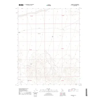
2018 Map of Silurian Hills
USGS Topo · Published 2018About this map
Valjean and the surrounding basins of the Mojave Desert characterize this arid reach of San Bernardino County. The landscape is defined by the elevation changes between the Silurian Hills and the lower stretches of the Valjean Valley and Silurian Valley. While the topography is the dominant feature, the 2018 survey reveals the network of desert tracks and county roads, such as Riggs Rd and Silurian Lake Rd, that provide access to this isolated interior. The mapping illustrates the Township and Range system (T18N R8E through T16N R9E) as it overlays the natural landforms, marking the intersection of public land management and the open desert environment.
Find a feature on this map
17 named features on this map. Tap any name to fly to it.
Don’t see what you’re looking for? This feature index may not catch every label — zoom into the map to look around manually.
Map Details
Editions of this 2018 Silurian Hills Map
This is the sole edition of this map. No revisions or reprints were ever made.
Other maps of this area

1910 · Ivanpah
USGS Topo · 1:250,000

1912 · Ivanpah
USGS Topo · 1:250,000

1933 · Avawatz Mountains
USGS Topo · 1:250,000

1942 · Ivanpah
USGS Topo · 1:250,000

1947 · Trona
USGS Topo · 1:250,000

1947 · Kingman
USGS Topo · 1:250,000

1948 · Kingman
USGS Topo · 1:250,000

1948 · Trona
USGS Topo · 1:250,000

1953 · Trona
USGS Topo · 1:250,000

1954 · Kingman
USGS Topo · 1:250,000