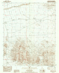
1983 Map of Silurian Hills
USGS Topo · Published 1983About this map
Valjean Valley and the rugged Silurian Hills dominate this Mojave Desert landscape, which preserves the remnants of early 20th-century mining and transit. The map identifies the former locations of Valjean and Riggs, both designated as sites by the 1980s, providing a reference for those studying the ghost towns of San Bernardino County. Historically significant infrastructure is visible in the form of the Old RR Grade, which cuts through the valley floor. Near the southern edge of the hills, the Riggs Mine and various prospects indicate the mineral exploration that once drew settlers to this arid region. The drainage of Kingston Wash provides a primary geographical landmark in the northern section, while numerous bench marks from 1909 and 1979 surveys, such as Usgs BM 44, offer precise data points for historical geodetic study.
Find a feature on this map
19 named features on this map. Tap any name to fly to it.
Don’t see what you’re looking for? This feature index may not catch every label — zoom into the map to look around manually.
Map Details
Editions of this 1983 Silurian Hills Map
This is the sole edition of this map. No revisions or reprints were ever made.
Other maps of this area

1910 · Ivanpah
USGS Topo · 1:250,000

1912 · Ivanpah
USGS Topo · 1:250,000

1933 · Avawatz Mountains
USGS Topo · 1:250,000

1942 · Ivanpah
USGS Topo · 1:250,000

1947 · Trona
USGS Topo · 1:250,000

1947 · Kingman
USGS Topo · 1:250,000

1948 · Kingman
USGS Topo · 1:250,000

1948 · Trona
USGS Topo · 1:250,000

1953 · Trona
USGS Topo · 1:250,000

1954 · Kingman
USGS Topo · 1:250,000