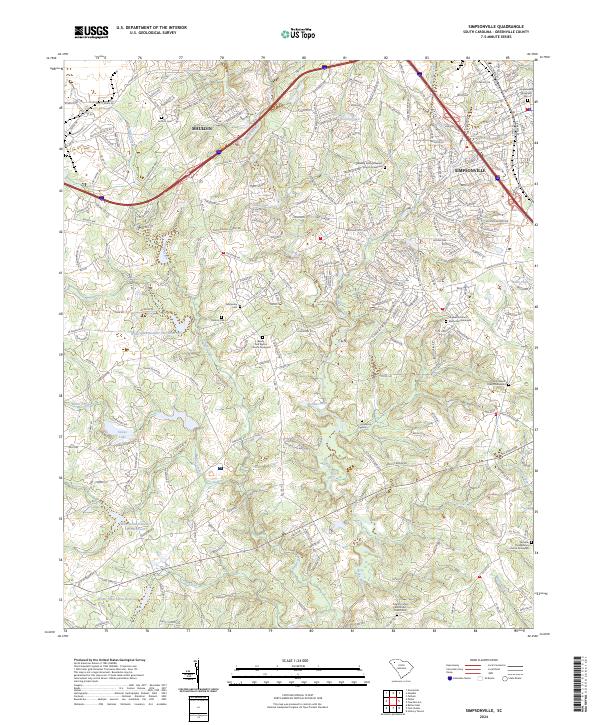
2024 Map of Simpsonville
USGS Topo · Published 2024About this map
The Reedy River and its numerous tributaries, including Huff Creek, Baker Creek, and Rocky Creek, carve a rolling path through this portion of Greenville County. The landscape is defined by its transition from the municipal centers of Mauldin and Simpsonville in the north to a more dispersed pattern of reservoirs and family-named graveyards in the south. These cemeteries, such as the Standing Springs Baptist Church Graveyard and Hopewell United Methodist Graveyard, serve as critical anchors for local genealogy and neighborhood identity. Several significant water management features, including Water Shed Number One Reservoir and Water Shed Three Reservoir, punctuate the terrain alongside smaller bodies like Goochs Lake and Snows Lake. The road network, though increasingly modernized, still follows historical routes like Old Stage Rd and Saint Albans School Rd, reflecting the long-standing settlement patterns of the South Carolina Piedmont.
Find a feature on this map
238 named features on this map. Tap any name to fly to it.
Don’t see what you’re looking for? This feature index may not catch every label — zoom into the map to look around manually.
Map Details
Editions of this 2024 Simpsonville Map
This is the sole edition of this map. No revisions or reprints were ever made.
Other maps of this area

1935 · Greer
USGS Topo · 1:48,000

1935 · Greenville
USGS Topo · 1:48,000

1938 · Greenville
USGS Topo · 1:62,500

1938 · Greer
USGS Topo · 1:62,500

1954 · Greenville
USGS Topo · 1:250,000

1957 · Fountain Inn
USGS Topo · 1:62,500

1957 · Greenville
USGS Topo · 1:24,000

1957 · Williamston
USGS Topo · 1:62,500

1957 · Greer
USGS Topo · 1:62,500

1957 · Greenville
USGS Topo · 1:62,500
Featured Places
- Mauldin, SC
- Simpsonville, SC
- Westwood, Simpsonville
- Cherokee Heights, Simpsonville
- Greenville County, SC