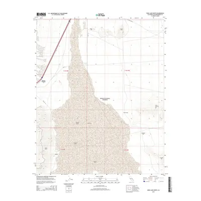
2015 Map of Soda Lake North
USGS Topo · Published 2015About this map
Zzyzx sits at the southwestern edge of the expansive Soda Lake basin, a prominent terminal sink within the Mojave National Preserve. This 2015 survey illustrates a landscape defined by dramatic elevation changes between the flat alkali sink and the surrounding peaks. Distinctive volcanic and geological formations like Chocolate Drop, Noels Knoll, and Donnell Hill punctuate the arid terrain. To the north, the elevation rises toward Hanks Mtn and Squat Hill, while the eastern border is dominated by the Little Cowhole Mtn and Cowhole Mtn ridges. Transport through this desert environment is marked by the course of Zzyzx Rd and Brannigan Mine Rd, indicating a history of mineral exploration and specialized settlement. Rare water sources like Mesquite Spring and Zzyzx Spring provide critical landmarks in an otherwise dry expanse, serving as focal points for both historical use and modern conservation.
Find a feature on this map
23 named features on this map. Tap any name to fly to it.
Don’t see what you’re looking for? This feature index may not catch every label — zoom into the map to look around manually.
Map Details
Editions of this 2015 Soda Lake North Map
This is the sole edition of this map. No revisions or reprints were ever made.
Other maps of this area

1910 · Ivanpah
USGS Topo · 1:250,000

1912 · Ivanpah
USGS Topo · 1:250,000

1933 · Avawatz Mountains
USGS Topo · 1:250,000

1942 · Ivanpah
USGS Topo · 1:250,000

1947 · Trona
USGS Topo · 1:250,000

1947 · Kingman
USGS Topo · 1:250,000

1948 · Kingman
USGS Topo · 1:250,000

1948 · Trona
USGS Topo · 1:250,000

1953 · Trona
USGS Topo · 1:250,000

1954 · Kingman
USGS Topo · 1:250,000