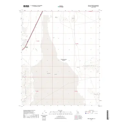
2018 Map of Soda Lake North
USGS Topo · Published 2018About this map
The vast expanse of Soda Lake dominates the center of this terrain, a dry playa within the Mojave National Preserve that serves as the terminus of the Mojave River. In the southwestern corner, Zzyzx Spring indicates the site of a historic oasis and mineral health resort, while Desert Heights represents the only named settlement on this sheet, situated along the corridor of Interstate 15. To the east, the landscape is defined by stark volcanic and metamorphic peaks including Hanks Mtn, Little Cowhole Mtn, and Cowhole Mtn. Small, intermittent water sources like Mesquite Spring and Shortz Lake are scattered across the desert floor, hinting at the difficult hydrology of the region and the critical nature of these landmarks for early travel and ranching in the Mojave Desert.
Find a feature on this map
18 named features on this map. Tap any name to fly to it.
Don’t see what you’re looking for? This feature index may not catch every label — zoom into the map to look around manually.
Map Details
Editions of this 2018 Soda Lake North Map
This is the sole edition of this map. No revisions or reprints were ever made.
Other maps of this area

1910 · Ivanpah
USGS Topo · 1:250,000

1912 · Ivanpah
USGS Topo · 1:250,000

1933 · Avawatz Mountains
USGS Topo · 1:250,000

1942 · Ivanpah
USGS Topo · 1:250,000

1947 · Trona
USGS Topo · 1:250,000

1947 · Kingman
USGS Topo · 1:250,000

1948 · Kingman
USGS Topo · 1:250,000

1948 · Trona
USGS Topo · 1:250,000

1953 · Trona
USGS Topo · 1:250,000

1954 · Kingman
USGS Topo · 1:250,000