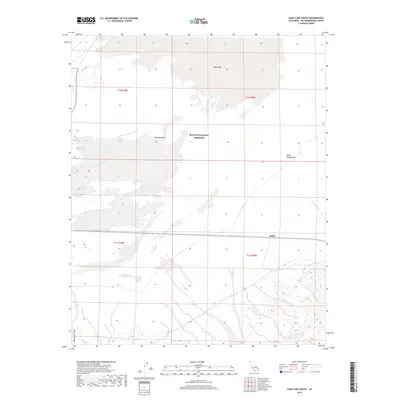
2018 Map of Soda Lake South
USGS Topo · Published 2018About this map
Soda Lake dominates the northern portion of this landscape, its expansive basin reflecting the ephemeral nature of water in the Mojave Desert. The map records a transition from the salt-encrusted flat of the lake to the shifting sands of the Devils Playground and the complex drainage systems of the Mojave River Wash and Kelso Wash. Located within the Mojave National Preserve, the area is defined by its arid hydrology and significant topographical variations, ranging from the low-lying lake bed to the elevated Mesquite Hills in the southwest corner. The small settlement of Balch sits along the rail line traversing the southern half of the quadrangle, serving as a primary point of human infrastructure in an otherwise desert environment. This 2018 survey provides an essential look at the modern land management boundaries and the persistent natural landmarks that have shaped navigation through San Bernardino County for generations.
Find a feature on this map
12 named features on this map. Tap any name to fly to it.
Don’t see what you’re looking for? This feature index may not catch every label — zoom into the map to look around manually.
Map Details
Editions of this 2018 Soda Lake South Map
This is the sole edition of this map. No revisions or reprints were ever made.
Other maps of this area

1910 · Ivanpah
USGS Topo · 1:250,000

1912 · Ivanpah
USGS Topo · 1:250,000

1933 · Avawatz Mountains
USGS Topo · 1:250,000

1942 · Ivanpah
USGS Topo · 1:250,000

1942 · Amboy
USGS Topo · 1:250,000

1943 · Amboy
USGS Topo · 1:250,000

1947 · Trona
USGS Topo · 1:250,000

1947 · Kingman
USGS Topo · 1:250,000

1948 · Kingman
USGS Topo · 1:250,000

1948 · Trona
USGS Topo · 1:250,000