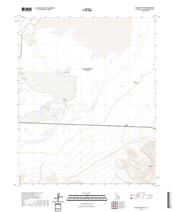
2021 Map of Soda Lake South
USGS Topo · Published 2021About this map
The Mojave National Preserve landscape is defined by the arid transition between massive dune systems and high desert ranges. In this 2021 survey of San Bernardino County, the Mojave River Wash and Kelso Wash dominate the central drainage patterns, carving through the sprawling Devils Playground. These ephemeral watercourses are critical markers for understanding the historical movement of people and livestock through this challenging environment, where reliable water was scarce and travel depended on following established washes.
Find a feature on this map
15 named features on this map. Tap any name to fly to it.
Don’t see what you’re looking for? This feature index may not catch every label — zoom into the map to look around manually.
Map Details
Editions of this 2021 Soda Lake South Map
This is the sole edition of this map. No revisions or reprints were ever made.
Other maps of this area

1910 · Ivanpah
USGS Topo · 1:250,000

1912 · Ivanpah
USGS Topo · 1:250,000

1933 · Avawatz Mountains
USGS Topo · 1:250,000

1942 · Ivanpah
USGS Topo · 1:250,000

1942 · Amboy
USGS Topo · 1:250,000

1943 · Amboy
USGS Topo · 1:250,000

1947 · Trona
USGS Topo · 1:250,000

1947 · Kingman
USGS Topo · 1:250,000

1948 · Kingman
USGS Topo · 1:250,000

1948 · Trona
USGS Topo · 1:250,000