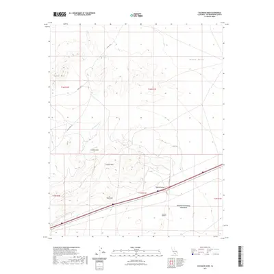
2021 Map of Solomons Knob
USGS Topo · Published 2021About this map
Yucca Grove serves as a lone commercial outpost along the transit corridor of the Mojave Desert, marking a stark transition between the high peaks and the expansive desert basins. This high-desert landscape is defined by its strategic water sources and topographic landmarks, including Francis Spring and Bull Spring, which have historically dictated travel routes through the arid terrain. The northern portion of the map is dominated by the rugged elevations of Squaw Mtn and Solomons Knob, while the southern reaches fall within the protected boundaries of the Mojave National Preserve. Transport through this section of San Bernardino County relies on the Interstate corridor and historical paths like Francis Springs Rd, which skirts the edge of Shadow Valley. The map details the complex drainage systems of Bull Spring Wash and Halloran Wash, illustrating the natural flow towards the lower desert floor near Halloran Summit.
Find a feature on this map
21 named features on this map. Tap any name to fly to it.
Don’t see what you’re looking for? This feature index may not catch every label — zoom into the map to look around manually.
Map Details
Editions of this 2021 Solomons Knob Map
This is the sole edition of this map. No revisions or reprints were ever made.
Other maps of this area

1910 · Ivanpah
USGS Topo · 1:250,000

1912 · Ivanpah
USGS Topo · 1:250,000

1942 · Ivanpah
USGS Topo · 1:250,000

1947 · Kingman
USGS Topo · 1:250,000

1948 · Kingman
USGS Topo · 1:250,000

1954 · Kingman
USGS Topo · 1:250,000

1955 · Kingman
USGS Topo · 1:250,000

1955 · Kingston Peak
USGS Topo · 1:62,500

1955 · Mescal Range
USGS Topo · 1:62,500

1956 · Halloran Spring
USGS Topo · 1:62,500