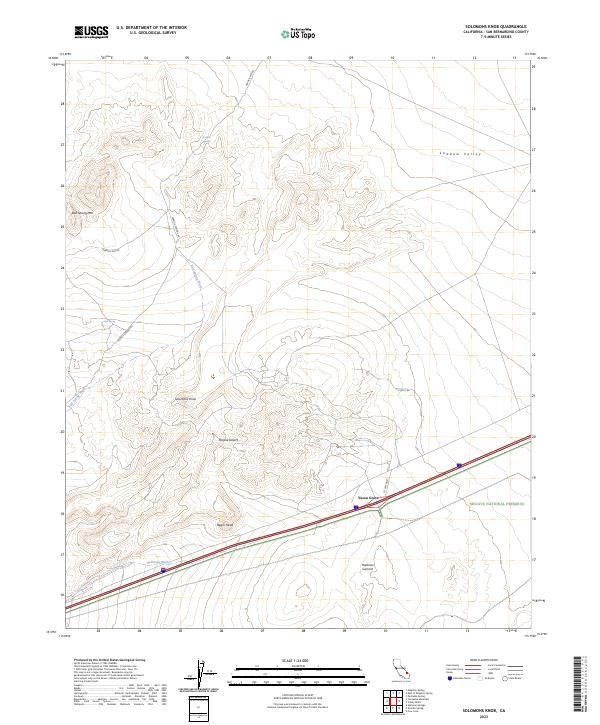
2023 Map of Solomons Knob
USGS Topo · Published 2023About this map
Yucca Grove serves as the primary point of human activity in this corner of the Mojave Desert, positioned where the highway cuts through a landscape defined by isolated peaks and seasonal washes. The terrain rises to high points such as Solomons Knob and Bull Spring Mtn, while the wide expanse of Shadow Valley occupies the northern reaches. This 2023 survey illustrates the balance between modern travel corridors and protected land, with the Mojave National Preserve and Mojave Wilderness safeguarding the eastern and southern sections of the sheet. Vital water sources for desert navigation, such as Francis Spring and Bull Spring, are linked by remote tracks like Francis Springs Rd, tracing the same paths utilized by travelers for generations through Halloran Wash and past Halloran Summit.
Find a feature on this map
22 named features on this map. Tap any name to fly to it.
Don’t see what you’re looking for? This feature index may not catch every label — zoom into the map to look around manually.
Map Details
Editions of this 2023 Solomons Knob Map
This is the sole edition of this map. No revisions or reprints were ever made.
Other maps of this area

1910 · Ivanpah
USGS Topo · 1:250,000

1912 · Ivanpah
USGS Topo · 1:250,000

1942 · Ivanpah
USGS Topo · 1:250,000

1947 · Kingman
USGS Topo · 1:250,000

1948 · Kingman
USGS Topo · 1:250,000

1954 · Kingman
USGS Topo · 1:250,000

1955 · Kingman
USGS Topo · 1:250,000

1955 · Kingston Peak
USGS Topo · 1:62,500

1955 · Mescal Range
USGS Topo · 1:62,500

1956 · Halloran Spring
USGS Topo · 1:62,500