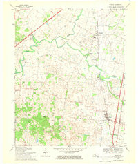
1967 Map of Sonora
USGS Topo · Published 1968About this map
Sonora and Glendale anchor the eastern corridor of this Kentucky landscape, which is defined by the sharp contrast between modern transportation and traditional rural settlements. The Louisville And Nashville railroad and the Western Kentucky Parkway cut through the terrain, illustrating the region's role as a transit artery. Despite this infrastructure, the map reveals a community deeply rooted in its local landmarks, from the industrial imprint of Star Mills to the social centers of St Ignatius Ch and Gilead Ch. Along the meandering Nolin River, smaller clusters like Boiling Spring and Nolin sit amidst a network of family-named sites such as Stone Cem and Skees Spring. To the south, the topography rises toward Silver Mine Knob, while the Glen Dale Childrens Home stands as a significant institutional landmark near the Hardin and LaRue County line.
Find a feature on this map
32 named features on this map. Tap any name to fly to it.
Don’t see what you’re looking for? This feature index may not catch every label — zoom into the map to look around manually.
Map Details
Editions of this 1967 Sonora Map
This is the sole edition of this map. No revisions or reprints were ever made.
Other maps of this area

1925 · Cub Run
USGS Topo · 1:62,500

1932 · Big Clifty
USGS Topo · 1:62,500

1934 · Munfordville
USGS Topo · 1:48,000

1935 · Elizabethtown
USGS Topo · 1:48,000

1937 · Munfordville
USGS Topo · 1:62,500

1938 · Elizabethtown
USGS Topo · 1:62,500

1948 · Cecilia
USGS Topo · 1:24,000

1949 · Sonora
USGS Topo · 1:24,000

1949 · Tonieville
USGS Topo · 1:24,000

1949 · Summit
USGS Topo · 1:24,000