2024 Map of Sorrento
USGS Topo · Published 2024About this map
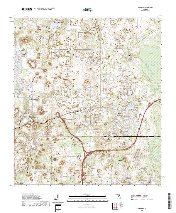
Sorrento and Mount Plymouth anchor this central Florida landscape, where the sandy ridges of Lake County meet the wetland systems of the Wekiva Wild and Scenic River. The terrain is defined by a dense concentration of water bodies, from Lake Seneca in the north to the Neighborhood Lakes in the south, reflecting the karst topography of the region. Scattered settlements like Seneca and Seminole Springs are interspersed with smaller burial grounds such as Seneca Cem and Sorrento Cem, providing valuable points of reference for local family history.
Find a feature on this map
249 named features on this map. Tap any name to fly to it.
Don’t see what you’re looking for? This feature index may not catch every label — zoom into the map to look around manually.
Map Details
Editions of this 2024 Sorrento Map
This is the sole edition of this map. No revisions or reprints were ever made.