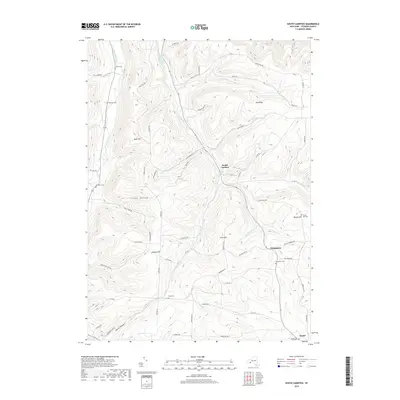
2019 Map of South Canisteo
USGS Topo · Published 2019About this map
Colonel Bills Creek carves a deep valley through the center of this Steuben County landscape, defining the local topography and settlement patterns of this 2019 survey. The hamlet of South Canisteo sits at the junction of several drainage runs, while the village of Jasper occupies the southeastern corner. The map reveals a high density of rural burial grounds, including Hampshire Cem, Gully Cem, and Marsh Hill Cem, which serve as vital landmarks for genealogists tracing early families in the region.
Find a feature on this map
65 named features on this map. Tap any name to fly to it.
Don’t see what you’re looking for? This feature index may not catch every label — zoom into the map to look around manually.
Map Details
Editions of this 2019 South Canisteo Map
This is the sole edition of this map. No revisions or reprints were ever made.
Other maps of this area

1910 · Bath
USGS Topo · 1:62,500

1915 · Hornell
USGS Topo · 1:62,500

1918 · Hornell
USGS Topo · 1:62,500

1924 · Woodhull
USGS Topo · 1:48,000

1926 · Woodhull
USGS Topo · 1:62,500

1926 · Greenwood
USGS Topo · 1:62,500

1944 · Woodhull
USGS Topo · 1:62,500

1950 · Elmira
USGS Topo · 1:250,000

1953 · Cameron
USGS Topo · 1:24,000

1953 · Woodhull
USGS Topo · 1:24,000