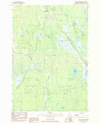
1983 Map of South Lagrange
USGS Topo · Published 1984About this map
South Lagrange and the small settlement of Gerry anchor this 1980s landscape at the corner of Penobscot County where Lagrange, Bradford, Alton, and Hudson meet. The terrain is defined by a dense network of wetlands and ridges, including the extensive Sargent Bog and the elevated Hudson Ridge. The local economy of the era is evidenced by transportation corridors like Tannery Road and industrial infrastructure such as the Bangor and Aroostook Railroad Grade. Numerous water features, including Pickerel Pond, Holland Pond, and Christian Spring, suggest a landscape shaped by persistent drainage patterns and local water sources. The map also traces an Old RR Grade and the course of the Dead Stream, reflecting the historical movement of timber and materials through this interior Maine woodland.
Find a feature on this map
34 named features on this map. Tap any name to fly to it.
Don’t see what you’re looking for? This feature index may not catch every label — zoom into the map to look around manually.
Map Details
Editions of this 1983 South Lagrange Map
This is the sole edition of this map. No revisions or reprints were ever made.
Other maps of this area

1902 · Orono
USGS Topo · 1:62,500

1902 · Bangor
USGS Topo · 1:62,500

1917 · Passadumkeag
USGS Topo · 1:62,500

1933 · Boyd Lake
USGS Topo · 1:62,500

1942 · Bangor
USGS Topo · 1:62,500

1944 · Orono
USGS Topo · 1:62,500

1946 · Bangor
USGS Topo · 1:62,500

1946 · Orono
USGS Topo · 1:62,500

1948 · Bangor
USGS Topo · 1:250,000

1951 · Boyd Lake
USGS Topo · 1:50,000