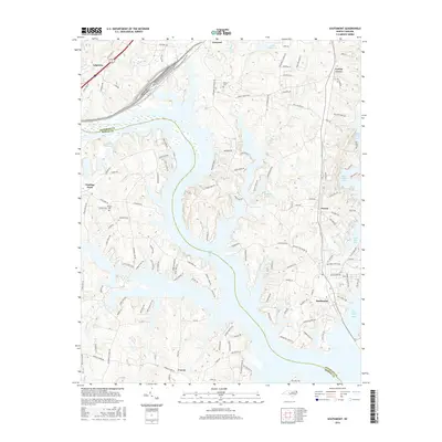
2016 Map of Southmont
USGS Topo · Published 2016About this map
High Rock Lake dominates the central landscape of this section of Davidson and Rowan counties, its complex fingers and inlets shaping the surrounding communities. The map captures the interface between the sprawling reservoir and long-established settlements like Southmont and Feezor. To the north, Linwood sits near the rail lines while the historic Jersey Cem and Cotton Grove represent the area's deep-rooted residential character. The western edge is defined by the historic crossing at Trading Ford, where the terrain drops toward the river's edge. This 2016 survey illustrates a modern suburban-rural mix, where secondary roads like Linwood-Southmont Rd connect smaller bodies of water such as Clodfelter Lake and Cobles Reservoir to the larger river system, reflecting the area's transition from agricultural foundations to a landscape defined by water-based recreation and utility.
Find a feature on this map
131 named features on this map. Tap any name to fly to it.
Don’t see what you’re looking for? This feature index may not catch every label — zoom into the map to look around manually.
Map Details
Editions of this 2016 Southmont Map
This is the sole edition of this map. No revisions or reprints were ever made.
Other maps of this area

1949 · High Rock
USGS Topo · 1:24,000

1949 · Denton NW
USGS Topo · 1:24,000

1950 · Lexington East
USGS Topo · 1:24,000

1950 · Lexington West
USGS Topo · 1:24,000

1950 · Churchland
USGS Topo · 1:24,000

1951 · Churchland
USGS Topo · 1:24,000

1951 · Lexington East
USGS Topo · 1:24,000

1951 · Lexington West
USGS Topo · 1:24,000

1953 · Charlotte
USGS Topo · 1:250,000

1954 · Charlotte
USGS Topo · 1:250,000