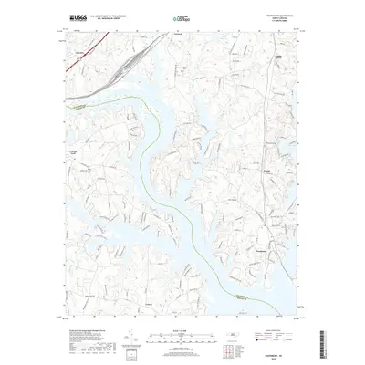
2019 Map of Southmont
USGS Topo · Published 2019About this map
Southmont and the surrounding shoreline of the Yadkin River basin define this portion of the Davidson Co Rowan Co border. The landscape is characterized by a dense network of residential and agricultural roads, reflecting the modern development of communities like Feezor and Cotton Grove near the water's edge. Historical continuity is visible in the placement of the Jersey Cem and Bethel Cem, which sit among newer developments and winding lakefront drives.
Find a feature on this map
137 named features on this map. Tap any name to fly to it.
Don’t see what you’re looking for? This feature index may not catch every label — zoom into the map to look around manually.
Map Details
Editions of this 2019 Southmont Map
This is the sole edition of this map. No revisions or reprints were ever made.
Other maps of this area

1949 · High Rock
USGS Topo · 1:24,000

1949 · Denton NW
USGS Topo · 1:24,000

1950 · Lexington East
USGS Topo · 1:24,000

1950 · Lexington West
USGS Topo · 1:24,000

1950 · Churchland
USGS Topo · 1:24,000

1951 · Churchland
USGS Topo · 1:24,000

1951 · Lexington East
USGS Topo · 1:24,000

1951 · Lexington West
USGS Topo · 1:24,000

1953 · Charlotte
USGS Topo · 1:250,000

1954 · Charlotte
USGS Topo · 1:250,000