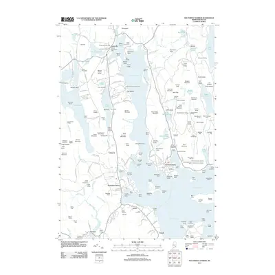
2011 Map of Southwest Harbor
USGS Topo · Published 2011About this map
Somes Sound bisects this portion of Mount Desert Island, serving as a focal point for the marine-oriented communities of Southwest Harbor, Northeast Harbor, and Manset. The map documents a landscape where the natural geography of Acadia National Park meets centuries of coastal settlement. Maritime infrastructure is highly detailed, from the Northeast Harbor Marina and Mount Desert Town Wharf to the Cranberry Isles Town Dock across the water.
Find a feature on this map
200 named features on this map. Tap any name to fly to it.
Don’t see what you’re looking for? This feature index may not catch every label — zoom into the map to look around manually.
Map Details
Editions of this 2011 Southwest Harbor Map
This is the sole edition of this map. No revisions or reprints were ever made.
Other maps of this area

1904 · Mount Desert
USGS Topo · 1:62,500

1904 · Swan Island
USGS Topo · 1:62,500

1904 · Bar Harbor
USGS Topo · 1:62,500

1942 · Bar Harbor
USGS Topo · 1:62,500

1942 · Mount Desert
USGS Topo · 1:62,500

1943 · Swans Island
USGS Topo · 1:62,500

1945 · Swans Island
USGS Topo · 1:62,500

1948 · Bangor
USGS Topo · 1:250,000

1956 · Bar Harbor
USGS Topo · 1:62,500

1956 · Mount Desert
USGS Topo · 1:62,500