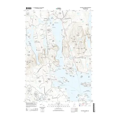
2014 Map of Southwest Harbor
USGS Topo · Published 2014About this map
Mount Desert Island is defined here by the deep indentation of Somes Sound, which nearly bisects the landmass. This 2014 survey captures the sophisticated intersection of residential settlements like Somesville, Northeast Harbor, and Southwest Harbor with the preserved landscape of Acadia National Park. The map reveals a legacy of granite extraction at Hall Quarry, a site that helped build many of America's coastal cities. Numerous family burial sites, such as the Clark Family Burying Ground, Richardson Burying Ground, and the Old Burying Ground, are preserved throughout the terrain, offering significant genealogical value. The topography is marked by notable peaks including Saint Sauveur Mtn and Mansell Mtn, while the park's historic infrastructure is highlighted by specialized crossings like Waterfall Bridge and the Asticou Trail Bridge. The maritime character of the region is evident in the complex shorelines of Somes Harbor and Norwood Cove, leading out toward the Atlantic Ocean.
Find a feature on this map
183 named features on this map. Tap any name to fly to it.
Don’t see what you’re looking for? This feature index may not catch every label — zoom into the map to look around manually.
Map Details
Editions of this 2014 Southwest Harbor Map
This is the sole edition of this map. No revisions or reprints were ever made.
Other maps of this area

1904 · Mount Desert
USGS Topo · 1:62,500

1904 · Swan Island
USGS Topo · 1:62,500

1904 · Bar Harbor
USGS Topo · 1:62,500

1942 · Bar Harbor
USGS Topo · 1:62,500

1942 · Mount Desert
USGS Topo · 1:62,500

1943 · Swans Island
USGS Topo · 1:62,500

1945 · Swans Island
USGS Topo · 1:62,500

1948 · Bangor
USGS Topo · 1:250,000

1956 · Bar Harbor
USGS Topo · 1:62,500

1956 · Mount Desert
USGS Topo · 1:62,500