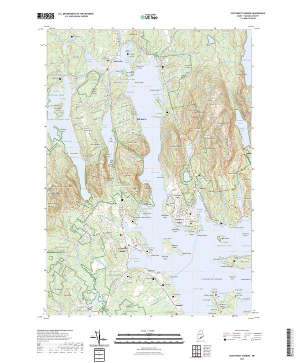
2024 Map of Southwest Harbor
USGS Topo · Published 2024About this map
Somesville sits at the northern head of Somes Sound, marking the historic heart of Mount Desert Island where coastal settlement patterns follow the deep-cut glacial fjords. The landscape is defined by the proximity of high granite peaks like Mansell Mtn and Bernard Mtn to protected harbors and coves. The map reveals an extensive network of family heritage through numerous scattered burial sites, such as the Spurling Revolutionary War Cem near Seawall and the Richardson Burying Ground near Hall Quarry. This 2024 data highlights the enduring maritime and village layout of Northeast Harbor and Southwest Harbor, where residential clusters meet the jagged coastline. From the high elevation of Beech Mtn to the low-lying Bass Harbor Marsh, the map documents the complex relationship between the protected lands of Acadia National Park and the established communities of Hancock County.
Find a feature on this map
221 named features on this map. Tap any name to fly to it.
Don’t see what you’re looking for? This feature index may not catch every label — zoom into the map to look around manually.
Map Details
Editions of this 2024 Southwest Harbor Map
This is the sole edition of this map. No revisions or reprints were ever made.
Other maps of this area

1904 · Mount Desert
USGS Topo · 1:62,500

1904 · Swan Island
USGS Topo · 1:62,500

1904 · Bar Harbor
USGS Topo · 1:62,500

1942 · Bar Harbor
USGS Topo · 1:62,500

1942 · Mount Desert
USGS Topo · 1:62,500

1943 · Swans Island
USGS Topo · 1:62,500

1945 · Swans Island
USGS Topo · 1:62,500

1948 · Bangor
USGS Topo · 1:250,000

1956 · Bar Harbor
USGS Topo · 1:62,500

1956 · Mount Desert
USGS Topo · 1:62,500