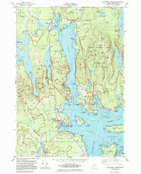
1983 Map of Southwest Harbor
USGS Topo · Published 1983About this map
Somes Sound carves a deep glacial fjord into the heart of Mount Desert Island, separating the high peaks of Acadia National Park from the established maritime villages of the early 1980s. The map details the intricate shoreline from the village of Somesville at the sound's head down to the busy docks of Southwest Harbor and Manset. This period of coastal development is marked by the prominence of the U S Coast Guard Station and the navigational importance of the Bear Island Lighthouse guarding the entrance to Northeast Harbor. Cultural landmarks such as St Marys by the Sea and Asticou highlight the area's summer colony traditions, while interior features like Hall Quarry and numerous family cemeteries including Mt Height Cem and Sheep Cem reflect the island's older industrial and residential roots.
Find a feature on this map
103 named features on this map. Tap any name to fly to it.
Don’t see what you’re looking for? This feature index may not catch every label — zoom into the map to look around manually.
Map Details
Editions of this 1983 Southwest Harbor Map
This is the sole edition of this map. No revisions or reprints were ever made.
Other maps of this area

1904 · Mount Desert
USGS Topo · 1:62,500

1904 · Swan Island
USGS Topo · 1:62,500

1904 · Bar Harbor
USGS Topo · 1:62,500

1942 · Bar Harbor
USGS Topo · 1:62,500

1942 · Mount Desert
USGS Topo · 1:62,500

1943 · Swans Island
USGS Topo · 1:62,500

1945 · Swans Island
USGS Topo · 1:62,500

1948 · Bangor
USGS Topo · 1:250,000

1956 · Bar Harbor
USGS Topo · 1:62,500

1956 · Mount Desert
USGS Topo · 1:62,500