Loading...
Loading map...2024 Map of Sparta
USGS Topo · Published 2024About this map
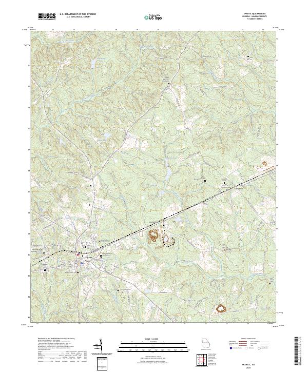
The town of Sparta serves as the focal point of this Hancock County landscape, where the historic street grid intersects with the Georgia RR. The map reveals a dense concentration of family and denominational burial grounds, such as the Holsey Memorial Cem Number 1, Brantley Family Cem, and Saint Mark African Methodist Episcopal Church Cem, highlighting the deep genealogical roots of the region.
Find a feature on this map
101 named features on this map. Tap any name to fly to it.
Don’t see what you’re looking for? This feature index may not catch every label — zoom into the map to look around manually.
Map Details
Date Portrayed2024
Date Published2024
PublisherU.S. Geological Survey
Map TypeTopographic
Scale1:24000
Physical Dimensions24 x 29 inches
Editions of this 2024 Sparta Map
This is the sole edition of this map. No revisions or reprints were ever made.
Historical Maps of Dixie Through Time
Featured Locations
Source Details
SourceU.S. Geological Survey
CopyrightPublic Domain