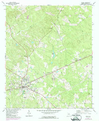
1972 Map of Sparta
USGS Topo · Published 1987About this map
Sparta, the historic seat of Hancock County, dominates this mid-1970s landscape, revealing a community defined by its civic institutions and proximity to the Csxt railroad. The town center features significant local landmarks such as Memorial Hospital, the Armory, and multiple educational campuses including Hancock Central High Sch and John Hancock Academy. Beyond the town limits, the geography is shaped by numerous granite quarries and a dense network of country churches like St Marks Ch and Smyrna Ch, which anchored the smaller rural settlements of Culverton and Granite Hill.
Find a feature on this map
34 named features on this map. Tap any name to fly to it.
Don’t see what you’re looking for? This feature index may not catch every label — zoom into the map to look around manually.
Map Details
Editions of this 1972 Sparta Map
2 editions found
Other maps of this area

1912 · Milledgeville
USGS Topo · 1:62,500

1953 · Athens
USGS Topo · 1:250,000

1958 · Athens
USGS Topo · 1:250,000

1959 · Athens
USGS Topo · 1:250,000

1960 · Warthen NE
USGS Topo · 1:24,000

1961 · Warthen NW
USGS Topo · 1:24,000

1963 · Athens
USGS Topo · 1:250,000

1972 · Shoulderbone
USGS Topo · 1:24,000

1972 · Sparta NW
USGS Topo · 1:24,000
1972 · Jewell
USGS Topo · 1:24,000