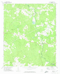
1972 Map of Jewell
USGS Topo · Published 1974About this map
The Ogeechee River carves a winding path through this rural landscape along the boundary of Hancock and Warren counties. The settlement of Jewell serves as a focal point near the river crossing, while the small community of Mayfield sits to the north. This mid-century survey illustrates a quiet, agriculture-centered region characterized by numerous country churches, such as Horeb Ch and Martin Tabernacle Ch, which likely served as anchors for the surrounding rural families.
Find a feature on this map
23 named features on this map. Tap any name to fly to it.
Don’t see what you’re looking for? This feature index may not catch every label — zoom into the map to look around manually.
Map Details
Editions of this 1972 Jewell Map
2 editions found
Other maps of this area

1953 · Athens
USGS Topo · 1:250,000

1958 · Athens
USGS Topo · 1:250,000

1959 · Athens
USGS Topo · 1:250,000

1960 · Warthen NE
USGS Topo · 1:24,000

1961 · Warthen NW
USGS Topo · 1:24,000

1963 · Athens
USGS Topo · 1:250,000

1971 · Beall Springs
USGS Topo · 1:24,000

1972 · Sparta NW
USGS Topo · 1:24,000
1972 · Mitchell
USGS Topo · 1:24,000
1972 · Sparta
USGS Topo · 1:24,000