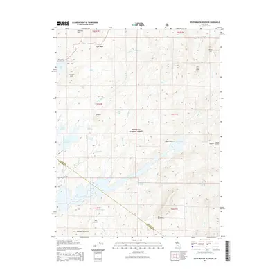
2015 Map of Spicer Meadow Reservoir
USGS Topo · Published 2015About this map
Spicer Meadow Reservoir and its surrounding watershed dominate this portion of the Stanislaus National Forest, straddling the high-elevation boundary between Alpine and Tuolumne counties. The landscape is defined by massive granite formations and water management, featuring significant landmarks like Elephant Rock and the towering basalt peaks of The Dardanelles. North of the main reservoir, a network of smaller alpine basins includes Lake Alpine, Utica Reservoir, and Union Reservoir, which serve as critical nodes for regional water storage and recreation. Evidence of early Forest Service access is visible through numerous designated routes such as Forest Rte 7N75 and 7n01. High peaks like Bull Run Peak and Henry Peak overlook narrow drainages such as Slaughter Canyon and Marshall Canyon, while meadows like Gabbott Meadow and Twin Meadows provide level ground amidst the steep slopes of Cape Horn and Inspiration Point.
Find a feature on this map
60 named features on this map. Tap any name to fly to it.
Don’t see what you’re looking for? This feature index may not catch every label — zoom into the map to look around manually.
Map Details
Editions of this 2015 Spicer Meadow Reservoir Map
This is the sole edition of this map. No revisions or reprints were ever made.
Other maps of this area

1889 · Pyramid Peak
USGS Topo · 1:125,000

1889 · Markleeville
USGS Topo · 1:125,000

1891 · Markleeville
USGS Topo · 1:125,000

1891 · Big Trees
USGS Topo · 1:125,000

1891 · Pyramid Peak
USGS Topo · 1:125,000

1893 · Markleeville
USGS Topo · 1:125,000

1894 · Big Trees
USGS Topo · 1:125,000

1895 · Pyramid Peak
USGS Topo · 1:125,000

1896 · Dardanelles
USGS Topo · 1:125,000

1896 · Pyramid Peak
USGS Topo · 1:125,000