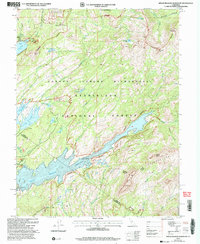
2001 Map of Spicer Meadow Reservoir
USGS Topo · Published 2004About this map
Spicer Meadow Reservoir dominates this high-country landscape, its expansive waters fed by the North Fork Stanislaus River and surrounded by the protected reaches of the Stanislaus National Forest. The map illustrates a complex network of glacial lakes and reservoirs, including Union Reservoir, Utica Reservoir, and Lake Alpine, all vital components of the region's hydroelectric and water storage infrastructure. Infrastructure such as the Spicer Power Plant and a nearby Gaging Station indicate the industrial utilization of the local watershed during the early 21st century.
Find a feature on this map
46 named features on this map. Tap any name to fly to it.
Don’t see what you’re looking for? This feature index may not catch every label — zoom into the map to look around manually.
Map Details
Editions of this 2001 Spicer Meadow Reservoir Map
This is the sole edition of this map. No revisions or reprints were ever made.
Other maps of this area

1889 · Pyramid Peak
USGS Topo · 1:125,000

1889 · Markleeville
USGS Topo · 1:125,000

1891 · Markleeville
USGS Topo · 1:125,000

1891 · Big Trees
USGS Topo · 1:125,000

1891 · Pyramid Peak
USGS Topo · 1:125,000

1893 · Markleeville
USGS Topo · 1:125,000

1894 · Big Trees
USGS Topo · 1:125,000

1895 · Pyramid Peak
USGS Topo · 1:125,000

1896 · Dardanelles
USGS Topo · 1:125,000

1896 · Pyramid Peak
USGS Topo · 1:125,000