Loading...
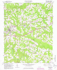
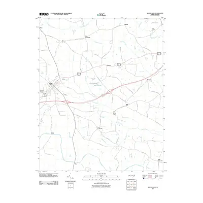
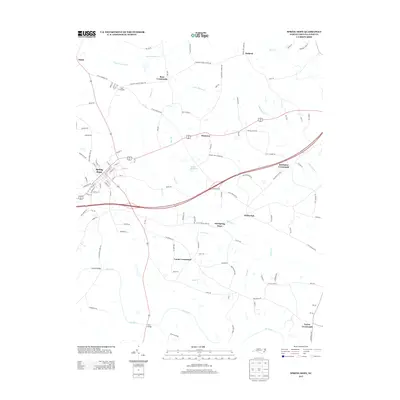
Loading map...1978 Map of Spring Hope
USGS Topo · Published 1982About this map
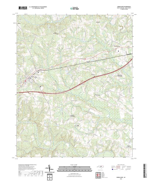
The Seaboard Coast Line railroad bisects this landscape, running through the heart of Spring Hope, where the Oakdale Cem and Spaulding Middle Sch mark the town's social fabric. This 1978 survey captures the rural character of western Nash County, characterized by a dense network of family-named crossroads and country churches like Batebelor Crossroads, Lamm Crossroads, and Bunn Chapel.
Find a feature on this map
39 named features on this map. Tap any name to fly to it.
Don’t see what you’re looking for? This feature index may not catch every label — zoom into the map to look around manually.
Map Details
Date Portrayed1978
Date Published1982
PublisherU.S. Geological Survey
Map TypeTopographic
Scale1:24,000
Physical Dimensions21.7 x 26.6 inches
Editions of this 1978 Spring Hope Map
This is the sole edition of this map. No revisions or reprints were ever made.
Historical Maps of Spring Hope Through Time
7 maps found

Featured Locations
Source Details
SourceU.S. Geological Survey
CopyrightPublic Domain