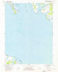
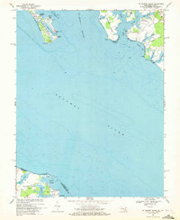
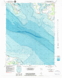
1968 Map of St. George Island
USGS Topo · Published 1976About this map
The St Marys River meets the Potomac River at this coastal boundary between Maryland and Virginia. This late-1960s survey illustrates a landscape defined by its deep maritime connection, with St George Island extending into the water, protected by St George Island Beach. To the east, the community of Wynne sits near the head of Smith Creek, while Clayton Marina and scattered cemeteries provide evidence of long-established waterfront life.
Find a feature on this map
39 named features on this map. Tap any name to fly to it.
Don’t see what you’re looking for? This feature index may not catch every label — zoom into the map to look around manually.
Map Details
Editions of this 1968 St. George Island Map
3 editions found
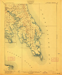
Other maps of this area

1892 · Piney Point
USGS Topo · 1:62,500

1894 · Piney Point
USGS Topo · 1:62,500

1894 · Point Lookout
USGS Topo · 1:62,500

1895 · Nomini
USGS Topo · 1:125,000

1895 · Piney Point
USGS Topo · 1:62,500

1898 · Nomini
USGS Topo · 1:125,000

1898 · St. Marys
USGS Topo · 1:125,000

1901 · Piney Point
USGS Topo · 1:62,500

1906 · St. Marys
USGS Topo · 1:125,000
1912 · Point Lookout
USGS Topo · 1:62,500