
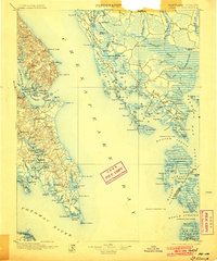
1898 Map of St. Marys
USGS Topo · Published 1898About this map
Chesapeake Bay dominates this late nineteenth-century maritime landscape, which covers the interconnected waterways of the Potomac River and Patuxent River. The mapping shows the intricate network of landings, points, and necks that defined Maryland's tidewater life before the advent of modern bridge systems. Small settlements like Great Mills and St. Leonard are depicted alongside coastal landmarks such as the Hooper Strait L.H. and the bustling waterfront at Solomons.
Find a feature on this map
158 named features on this map. Tap any name to fly to it.
Don’t see what you’re looking for? This feature index may not catch every label — zoom into the map to look around manually.
Map Details
Editions of this 1898 St. Marys Map
2 editions found
Other maps of this area

1892 · Leonardtown
USGS Topo · 1:62,500

1892 · Drum Point
USGS Topo · 1:62,500

1892 · Prince Frederick
USGS Topo · 1:62,500

1892 · Piney Point
USGS Topo · 1:62,500

1893 · Sharps Island
USGS Topo · 1:62,500

1894 · Piney Point
USGS Topo · 1:62,500

1894 · Point Lookout
USGS Topo · 1:62,500

1895 · Prince Frederick
USGS Topo · 1:62,500

1895 · Leonardtown
USGS Topo · 1:62,500

1895 · Nomini
USGS Topo · 1:125,000