
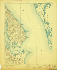
1892 Map of Drum Point
USGS Topo · Published 1892About this map
Cove Point and the surrounding Chesapeake shoreline define this coastal landscape at the end of the nineteenth century. Surveyed in 1890, the map illustrates the maritime character of Calvert, St Mary, and Dorchester counties. The deep waters of the Patuxent River meet the Chesapeake Bay at Drum Point, a critical navigation point marked by the Drum Pt. L.H. lighthouse. This area was a hub of late-century waterborne commerce and fishing, with small settlements like Solomon and Millstone providing anchorage. Inland, the terrain is deeply incised by tidal tributaries such as St.Leonard Creek and Hellen Creek, which allowed vessels to penetrate into the agricultural heartland. The scattered post offices and crossroad communities, including Lusby and Jarboesville, reflect the rural settlement patterns before modern bridge networks transformed the region.
Find a feature on this map
43 named features on this map. Tap any name to fly to it.
Don’t see what you’re looking for? This feature index may not catch every label — zoom into the map to look around manually.
Map Details
Editions of this 1892 Drum Point Map
2 editions found
Other maps of this area

1892 · Leonardtown
USGS Topo · 1:62,500

1892 · Prince Frederick
USGS Topo · 1:62,500

1892 · Piney Point
USGS Topo · 1:62,500

1893 · Sharps Island
USGS Topo · 1:62,500

1894 · Piney Point
USGS Topo · 1:62,500

1894 · Point Lookout
USGS Topo · 1:62,500

1895 · Prince Frederick
USGS Topo · 1:62,500

1895 · Leonardtown
USGS Topo · 1:62,500

1895 · Nomini
USGS Topo · 1:125,000

1895 · Piney Point
USGS Topo · 1:62,500