Old Maps of Lexington Park, Maryland
Explore 54 old maps of Lexington Park, spanning from 1892 to today. These high-resolution historic maps reveal how streets, neighborhoods, landmarks, and natural features evolved over time — perfect for genealogy, metal detecting, research, and local history exploration.
What you can do with these maps:
- See how Lexington Park changed over time: Compare historical maps to modern-day views to trace roads, homesites, rail lines & more.
- View detailed metadata: Each map includes creators, publishers, year, scale, and archive source.
- Overlay maps with satellite & LiDAR: Visualize the past alongside modern tools to explore terrain & human change.
- Trusted historical sources: Maps sourced from the USGS, Library of Congress, and other archives.
- Access maps your way: View online, download high-res files, or order prints for personal or research use.
Start exploring old maps of Lexington Park to uncover forgotten places, hidden landmarks, and the deep history beneath your feet.
Lexington Park, MD maps
(54)- 1892 Map of Leonardtown
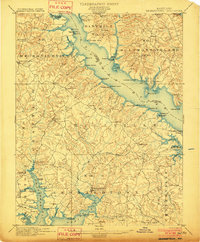
 1892 Leonardtown1892 Print · USGSSt. Mary's County at the end of the nineteenth century was a world of river wharves and tobacco landings. Trace the path of the Proposed Drum Point R.R. and locate family landmarks like Sotterly or Reeder Wharf along the Patuxent River.
 - 1892 Map of Drum Point
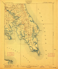
 1892 Drum Point1892 Print · USGSThe lower Chesapeake Bay and Patuxent River shoreline appear here in the early 1890s, when maritime trade governed local life. Genealogists and historians can locate old post offices like Lusby and Jarboesville or trace the early waterfront at Solomon and Drum Pt. L.H.2 unique versions available
 - 1892 Map of Piney Point
 1892 Piney Point1892 Print · USGSThe Potomac River tidewater is captured in the early 1890s, bridging the maritime communities of Maryland and Virginia. Genealogists can trace family lands near Kinsale, Nomini Grove, and the historic crossing at Mount Holly (Nomini Ferry).
 - 1894 Map of Piney Point
 1894 Piney Point1894 Print · USGSThe Lower Potomac during the late nineteenth century was a world of landings, ferries, and river-dependent villages. Genealogists and historians can trace old homesteads and crossings near Mount Holly (Nomini Ferry), Kinsale, and Valley Lee.
 - 1894 Map of Point Lookout
 1894 Point Lookout1894 Print · USGSSouthern St. Mary's County at the close of the nineteenth century was a world of landings and tidewater settlements. Researchers can trace historic river access at Bacon Wharf, locate the community of Ridge (Friendship), and study the shoreline of St. George Island.2 unique versions available
 - 1895 Map of Leonardtown
 1895 Leonardtown1895 Print · USGSSouthern Maryland in the 1890s is captured here as a river-centric landscape of wharves and crossroads. Researchers can trace the early maritime economy through landings like Reeder Wharf and Forest Wharf, or locate family sites in Hollywood and Leonardtown.
 - 1895 Map of Nomini
 1895 Nomini1895 Print · USGSSouthern Maryland and the Virginia tidewater shores meet along the Potomac in this late nineteenth-century survey. Genealogists can trace family holdings and river landings from Charlotte Hall down to Sotterly and the Nomini Ferry.
 - 1895 Map of Piney Point
 1895 Piney Point1895 Print · USGSThe Potomac River and its intricate Virginia and Maryland shorelines are revealed here in the late nineteenth century. Genealogists can trace family roots through landings and settlements like Kinsale, Hague, and Mount Holly (Nomini Ferry).
 - 1898 Map of Nomini
 1898 Nomini1898 Print · USGSMaryland and Virginia's Tidewater region comes alive in the late nineteenth century as a world of river landings, rail terminals, and rural crossroads. Researchers can trace the maritime economy through Nomini Ferry and Stone Wharf, or locate ancestral homesteads near Charlotte Hall and Potomac Mills.5 unique versions available
 - 1898 Map of St. Marys
 1898 St. Marys1898 Print · USGSMaryland's tidewater region is captured here in the late nineteenth century, showing the intricate geography of the lower Chesapeake. Genealogists can trace family roots through old landings and villages like Great Mills, Toddville, and Solomons.2 unique versions available
 - 1901 Map of Drum Point
 1901 Drum Point1901 Print · USGSThe maritime heart of the lower Chesapeake Bay comes alive in this turn-of-the-century survey of the Calvert and St. Mary’s coastline. Genealogists and historians can trace old landings and light stations like Millstone Landing, Spencers Wharf, and the Drum Pt. L.H. at the mouth of the Patuxent River.
 - 1901 Map of Leonardtown
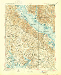
 1901 Leonardtown1901 Print · USGSMaryland's tidewater country at the turn of the century is defined by its deep reliance on the river and bay. Genealogists and historians can trace the vital maritime economy through old landings and wharves like Sotterly Wharf, Abells Wharf, and Coburns Wharf.3 unique versions available
 - 1901 Map of Piney Point
 1901 Piney Point1901 Print · USGSThe Potomac River tidewater at the opening of the twentieth century was a landscape of remote landings and river-bound commerce. Researchers can trace historic ferry crossings at Mount Holly, find the L.H. at Piney Point, or locate old mill sites like Clifton Mills.5 unique versions available
 - 1905 Map of Drum Point
 1905 Drum Point1905 Print · USGSThe Chesapeake Bay shoreline at the turn of the century shows a landscape defined by deep-water landings and remote island settlements. Genealogists and maritime historians can trace early wharves and landings like Spencers Wharf, Millstone Landing, and the village of Solomons.4 unique versions available
 - 1906 Map of St. Marys
 1906 St. Marys1906 Print · USGSChesapeake Bay and the Potomac River converge in this 1906 survey of the Maryland and Virginia tidewater. Historians can trace the region's maritime heritage through dozens of named landings and islands, from Solomons Id. to the remote reaches of Smith Island.4 unique versions available
 - 1912 Map of Point Lookout
 1912 Point Lookout1912 Print · USGSSouthern St. Mary's County appears here just after the turn of the century, showing a waterfront economy dependent on the river and bay. Genealogists and historians can trace family landings at Broomes Wharf and Miller Wharf or locate old settlements like St Inigoes and Great Mills.2 unique versions available
 - 1936 Map of Leonardtown
 1936 Leonardtown1936 Print · USGSSt. Mary's County wharves and rural parishes are captured in detail during the mid-1930s. Genealogists can trace family footprints at Old All Faith Ch, identify old school sites like Maryland Springs Sch, or locate historic landings such as Williams Wharf.
 - 1937 Map of Point Lookout, 1958 Print
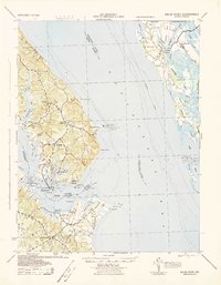
 1937 Point Lookout1958 Print · USGSThe tip of St. Mary's County appears here in the late thirties, where the Potomac meets the Chesapeake. Genealogists can trace family footprints through historic landings like Broomes Wharf and settlements such as St Inigoes and Drayden.2 unique versions available
 - 1939 Map of Leonardtown
 1939 Leonardtown1939 Print · USGSSouthern Maryland's river-oriented landscape is captured here in the late 1930s, centered on the community of Leonardtown. Genealogists can trace family roots through numerous country schools and landmarks like Bannaker Sch, St Andrews Ch, and the many landings along the Patuxent River.3 unique versions available
 - 1942 Map of Drum Point
 1942 Drum Point1942 Print · USGSThe Chesapeake Bay shoreline in the early 1940s reveals a world of maritime activity and isolated coastal communities. Genealogists and local historians can trace the foundations of Solomons, locate Spencers Wharf, and explore the marshes of Taylors Island.
 - 1943 Map of St. Marys City
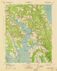 1943 St. Marys City1943 Print · USGSCoastal St. Mary's County is shown here during the early 1940s, when the river and bay still dictated the pace of life. Genealogists can trace old family sites and crossroads from Great Mills to St Inigoes, or locate historic landings like Broommes Wharf and Grason Ldg.4 unique versions available
 - 1943 Map of Piney Point
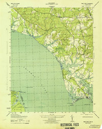 1943 Piney Point1943 Print · USGSCoastal St. Mary's County is captured mid-century as maritime tradition meets wartime expansion along the Potomac River. Researchers can locate family landmarks like Valley Lee, the Piney Point Lighthouse, and the Emergency Landing Field.
 - 1944 Map of Solomons Island
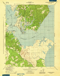 1944 Solomons Island1944 Print · USGSCoastal Maryland at the mouth of the Patuxent River is captured here in the mid-1940s, highlighting the expansion of the Naval Reservation. Genealogists and local historians can locate early communities like Johnstown, Jarboesville, and the Pearson Po settlement.4 unique versions available
 - 1948 Map of Washington
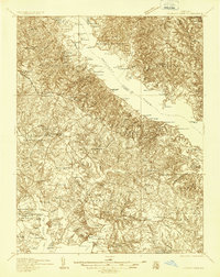
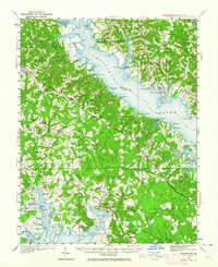
 1948 Washington1948 Print · USGSThe Potomac and Chesapeake regions in the late 1940s reveal a landscape of expanding military reach and deep-rooted Tidewater settlements. Trace old rail corridors like the Richmond Fredericksburg & Potomac RR or locate landmarks like the Wakefield Washington Monument and St. Marys College.2 unique versions available
 - 1950 Map of Leonardtown, 1964 Print
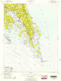
 1950 Leonardtown1964 Print · USGSMid-century Southern Maryland comes alive on this peninsula bounded by the Patuxent and Potomac estuaries. Genealogists and historians can trace family-named points and rural infrastructure through landmarks like St Andrews Ch, Williams Wharf, and Broomes Island.
Showing maps 1-25 of 54
Top cities near Lexington Park
- California historical maps
- Chesapeake Ranch Estates historical maps
- Wildewood historical maps
- Golden Beach historical maps
- Solomons historical maps
- Drum Point historical maps
See more
Top neighborhoods of Lexington Park
- Town Creek historical maps
- Spencers Wharf historical maps
- Great Mills historical maps
- North Town Creek Manor historical maps
- California historical maps
- Wildewood historical maps
See more
Frequently asked questions
- What are the different types of historical maps available for Lexington Park?
- What is the oldest map of Lexington Park?
- Where can I purchase historical maps of Lexington Park for my home or office?
- Where can I download high-res historical maps of Lexington Park?
- Are there historical topographic maps available for Lexington Park?
- Is there historical aerial imagery available for Lexington Park?
- Where are historical maps of Lexington Park sourced from?