2020s Maps of Lexington Park, Maryland
Explore 4 historic maps of Lexington Park from the 2020s. These maps offer a rare glimpse into what life looked like during the 2020s — showing old roads, neighborhoods, homes, and landmarks that have changed or disappeared over time.
Whether you're researching your family's past, planning a metal detecting trip, or studying how Lexington Park's landscape evolved across the 2020s, these high-resolution maps are a powerful tool for exploring the history of this region.
- Focus on a specific era: All maps on this page are from the 2020s, giving you a focused view of this time period.
- See what’s changed: Compare century-old streets, trails, and buildings to today's modern landscape using overlays and satellite layers.
- Research with precision: Use these maps for genealogy, historical research, land use analysis, or educational projects.
- View, download, or print: Maps are fully viewable online in high resolution, and can be downloaded or printed for your own records.
Start exploring Lexington Park's history through authentic maps from the 2020s. This is your window into the past.
Lexington Park, MD maps
(4)- 2023 Map of Hollywood, 2023 Print
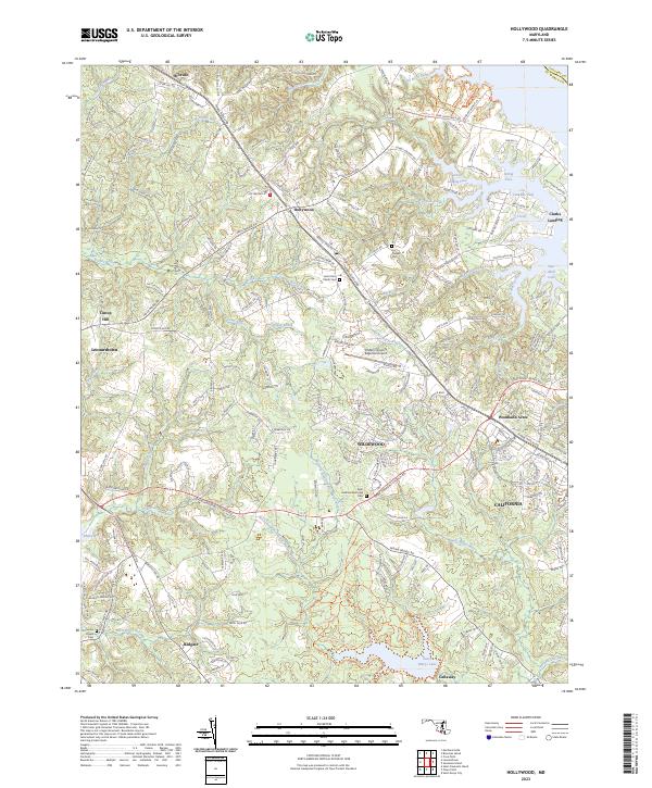 2023 Hollywood2023 Print · USGSSt. Mary's County comes into focus in this contemporary survey, capturing the modern suburban and maritime character of the Maryland peninsula. Researchers can trace historic church sites and parish grounds like Saint John Parish Cem and Our Ladys Chapel Cem amidst newer developments in California and Wildewood.
 - 2023 Map of Solomons Island, 2023 Print
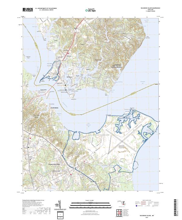 2023 Solomons Island2023 Print · USGSThe confluence of the Patuxent River and Chesapeake Bay is captured here in the 2020s, showing the modern layout of maritime villages and military installations. Researchers can trace family sites at Solomons Island Cem or explore the vast footprint of the Patuxent River Naval Air Station.
 - 2023 Map of Piney Point, 2023 Print
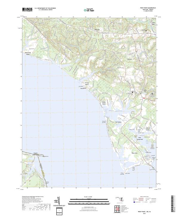 2023 Piney Point2023 Print · USGSCoastal St. Mary's County appears here in the early 21st century, showing the established communities and shoreline of the Potomac. Genealogists and researchers can trace family-named sites like McKay Beach or locate records at the Holy Face Parish Cem and Great Mills.
 - 2023 Map of Saint Marys City, 2023 Print
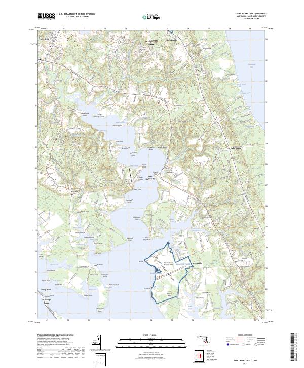 2023 Saint Marys City2023 Print · USGSCoastal St. Mary's County appears in the modern era as a blend of historic colonial sites and naval infrastructure. Local historians can trace family-named points and coves like Cherry Field Graveyard Point and Priests Point, alongside Saint Marys City and its collegiate grounds.
End of results
Showing maps 1-4 of 4
Top cities near Lexington Park
- California historical maps
- Chesapeake Ranch Estates historical maps
- Wildewood historical maps
- Golden Beach historical maps
- Solomons historical maps
- Drum Point historical maps
See more
Top neighborhoods of Lexington Park
- Town Creek historical maps
- Spencers Wharf historical maps
- Great Mills historical maps
- North Town Creek Manor historical maps
- California historical maps
- Wildewood historical maps
See more
Frequently asked questions
- What are the different types of historical maps available for Lexington Park?
- What is the oldest map of Lexington Park?
- Where can I purchase historical maps of Lexington Park for my home or office?
- Where can I download high-res historical maps of Lexington Park?
- Are there historical topographic maps available for Lexington Park?
- Is there historical aerial imagery available for Lexington Park?
- Where are historical maps of Lexington Park sourced from?