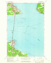
1964 Map of St. Ignace
USGS Topo · Published 1966About this map
The Mackinac Bridge dominates this mid-1960s study, connecting the Upper and Lower Peninsulas of Michigan across the Straits of Mackinac. This era shows a landscape where maritime history and modern infrastructure meet, anchored by St Ignace to the north and Mackinaw City to the south. The map documents the extensive ferry routes still active across the waters, navigating past hazards like North Graham Shoal and Majors Shoal.
Find a feature on this map
36 named features on this map. Tap any name to fly to it.
Don’t see what you’re looking for? This feature index may not catch every label — zoom into the map to look around manually.
Map Details
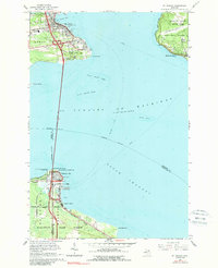
Editions of this 1964 St. Ignace Map
2 editions found
Other maps of this area

1931 · St Ignace NW
USGS Topo · 1:31,680

1931 · Moran NE
USGS Topo · 1:31,680

1932 · St Ignace NE
USGS Topo · 1:31,680

1948 · Moran NE
USGS Topo · 1:31,680

1955 · Cheboygan
USGS Topo · 1:250,000

1957 · Mullett Lake
USGS Topo · 1:62,500

1958 · Cheboygan
USGS Topo · 1:250,000

1958 · Pellston
USGS Topo · 1:62,500
1964 · Moran
USGS Topo · 1:24,000

1964 · Round Island
USGS Topo · 1:24,000
Featured Places
- Saint Ignace, MI
- Mackinaw City, MI
- Mackinac Island, MI
- Moran Township, MI
- Edgewater Beach, Mackinaw City