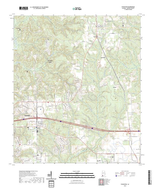
2024 Map of Stapleton
USGS Topo · Published 2024About this map
Stapleton sits at the heart of this Baldwin County landscape, where the headwaters of the Fish River and Styx River begin their descent toward the coast. The map reveals a transition from the structured residential blocks of Loxley and Daphne to the expansive rural tracts of Malbis and Bromley. Genealogical interest is particularly high here, with numerous small family and community burial grounds including the Bankester Cem, Dolive Cem, and the notable Jason Malbis Gravesite. The region's transport history is traced through routes like the Old Spanish Trail and Old Highway 31, which parallel modern corridors. Waterways such as Bay Minette Creek and Threemile Creek carve through the terrain, defining the local topography and historical drainage patterns near Steelwood and Berry Field.
Find a feature on this map
85 named features on this map. Tap any name to fly to it.
Don’t see what you’re looking for? This feature index may not catch every label — zoom into the map to look around manually.
Map Details
Editions of this 2024 Stapleton Map
This is the sole edition of this map. No revisions or reprints were ever made.
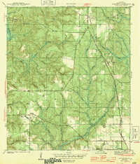
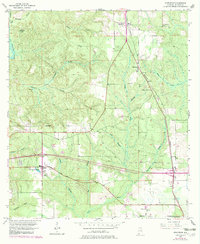
Historical Maps of Malbis Through Time
3 maps found