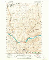
1950 Map of Starbuck
USGS Topo · Published 1950About this map
The confluence of the Snake River and the Palouse River anchor this mid-century look at the dramatic canyonlands and agricultural plateaus of southeastern Washington. The town of Starbuck sits along the southern edge, serving as a hub where the Tucannon River meets the heavy rail traffic of the Union Pacific and Northern Pacific lines. This era reflects a landscape defined by massive geologic features and strategic transportation, notably the Falls and its surrounding Palouse Falls State Park, alongside the vital Lyons Ferry crossing.
Find a feature on this map
36 named features on this map. Tap any name to fly to it.
Don’t see what you’re looking for? This feature index may not catch every label — zoom into the map to look around manually.
Map Details
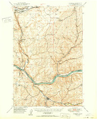
Editions of this 1950 Starbuck Map
This is the sole edition of this map. No revisions or reprints were ever made.