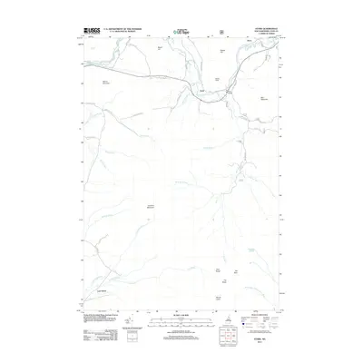
2012 Map of Stark
USGS Topo · Published 2012About this map
Stark serves as the focal point of this northern New Hampshire landscape, where the Upper Ammonoosuc River winds beneath the iconic Stark Bridge. The settlement patterns here are defined by the river valley and the steep rises of the Pilot Range, with several distinct peaks like Mount Cabot and The Horn dominating the southern terrain. To the northwest, the small community of Percy sits along the rail line near Dickey Hill, while the remote area known as Lost Nation occupies the southwestern corner near Cummings Brook. The map reveals a network of forest roads and spurs, such as Stark Spur C, that penetrate the high country around Hutchins Mountain, reflecting the area's history of timber access and mountain recreation. The contrast between the narrow valley floor and the massive granite features like Devils Slide underscores the geographical constraints on development in this portion of Coos County.
Find a feature on this map
44 named features on this map. Tap any name to fly to it.
Don’t see what you’re looking for? This feature index may not catch every label — zoom into the map to look around manually.
Map Details
Editions of this 2012 Stark Map
This is the sole edition of this map. No revisions or reprints were ever made.
Other maps of this area

1893 · Mt. Washington
USGS Topo · 1:62,500

1896 · Mt. Washington
USGS Topo · 1:62,500

1900 · Whitefield
USGS Topo · 1:62,500

1920 · Guildhall
USGS Topo · 1:62,500

1930 · Percy
USGS Topo · 1:62,500

1931 · Guildhall
USGS Topo · 1:48,000

1933 · Guildhall
USGS Topo · 1:48,000

1934 · Percy
USGS Topo · 1:62,500

1935 · Whitefield
USGS Topo · 1:48,000

1935 · Mt. Washington
USGS Topo · 1:62,500