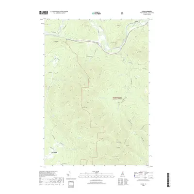
2018 Map of Stark
USGS Topo · Published 2018About this map
Stark Bridge and the small settlement of Percy anchor this reach of the Upper Ammonoosuc River valley, where the landscape transitions sharply from riverbank meadows to high granite peaks. The massive profile of Devils Slide looms over the valley floor, while further south, the terrain climbs into the heart of the White Mountain National Forest. This area is characterized by dense networks of forest roads and snowmobile trails like Stark Snomo, providing access to the rugged Pilot Range and the high elevations of Hutchins Mtn and Mt Cabot. Evidence of older transport routes and early settlements can be found in the western corridor, where Lost Nation sits near an Abandoned Town Rd, suggesting the historical contraction of remote homesteading in Coos County. Remote water bodies such as Unknown Pond are tucked along the Kilkenny Ridge, accessible only by trail.
Find a feature on this map
51 named features on this map. Tap any name to fly to it.
Don’t see what you’re looking for? This feature index may not catch every label — zoom into the map to look around manually.
Map Details
Editions of this 2018 Stark Map
This is the sole edition of this map. No revisions or reprints were ever made.
Other maps of this area

1893 · Mt. Washington
USGS Topo · 1:62,500

1896 · Mt. Washington
USGS Topo · 1:62,500

1900 · Whitefield
USGS Topo · 1:62,500

1920 · Guildhall
USGS Topo · 1:62,500

1930 · Percy
USGS Topo · 1:62,500

1931 · Guildhall
USGS Topo · 1:48,000

1933 · Guildhall
USGS Topo · 1:48,000

1934 · Percy
USGS Topo · 1:62,500

1935 · Whitefield
USGS Topo · 1:48,000

1935 · Mt. Washington
USGS Topo · 1:62,500